Frenchman Bay Regional Shellfish Committee Meeting
Lamoine Town Hall
January 18, 2017
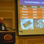
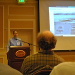
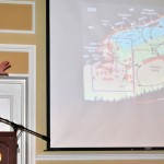
The Department of Marine Resources (DMR) and the Community Environmental Health Laboratory presented watershed information at the monthly Frenchman Bay Regional Shellfish Committee meeting at the Lamoine Town Hall. The DMR reported on water quality in Frenchman Bay, focusing on Martin Cove, Lamoine Beach, and the Trenton Seaplane Ramp, which are all listed as pollution areas. The DMR completed a shoreline sanitary survey in 2016, which identified new problem areas and resulted in four new Prohibited areas. The Community Environmental Health Laboratory is working on developing a watershed survey for identifying the pollution source(s) in Martin Cove, an area identified by the Frenchman Bay Regional Shellfish Committee as a priority area for its shellfish resource. They brought a proposed timeline, map, and example survey forms to share with the committee.


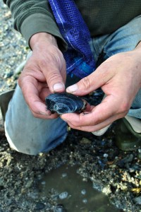
 Most of the available clam resource in Bar Harbor is at Hadley Point and in Thomas Bay. Clam harvests are regulated by the town which has an ordinance. There are conservation areas on the east and west side of Hadley Point. Both areas have been closed in the past for conservation, but are currently open for harvesting. The Bar Harbor Marine Resources Committee, in partnership with College of the Atlantic and MDI High School, has been active in conducting clam surveys. The last survey of the east side in fall 2009 revealed a peak of one inch clams. Two inch clams are the legal size for harvest. The resource on the east side of Hadley Point is generally larger than on the west side. The amount of spat recruitment is variable from year to year and probably does more to influence population size than conservation closures. In terms of conservation closures, the Bar Harbor Marine Resources Committee has learned that 6 month closures are ineffective. Two year closures will enable populations to re-bound, but given the current intensity of clamming, the positive effect of the closure is not long-lived.